In mobile ad-hoc networks the geographic routing protocol has high priority. This routing protocol maintains the nodes nearest to destination. It requires information about final destination of a packet and neighbor node positions. For maintaining the node updates a unique strategy is used known as Adaptive Position Update (APU).It uses two principles: nodes 1) whose moments are harder to predict & 2) closer to forwarding paths are updated frequently.
Keywords |
| wireless communication, algorithm/protocol design and analysis, routing protocols. |
I. INTRODUCTION |
| The term MANET (Mobile Ad-hoc Network) refers to a Multihop packet based wireless network composed of
a set of mobile nodes that can communicate and move at the same time, without using any kind of fixed wired
infrastructure. MANET is actually self-organizing and adaptive networks that can be formed and deformed on-the-fly
without the need of any centralized administration. Otherwise, a stand for “MOBILE AD HOC NETWORK” A MANET is a
type of ad hoc network that can change locations and configure itself on the fly. Because MANETS are mobile, they
use wireless connections to connect to various networks. |
II. RELATED WORK |
| A pure on-demand route acquisition system, nodes that do not lie on active paths neither maintain any routing
information nor participate in any periodic routing table exchanges. The routing tables of the nodes within the
neighbourhood are organized to optimize response time to local movements and provide quick response time for
requests for establishment of new routes. when a source node wants to find a route to another one, the source node
initiates a route discovery it broadcasts a route request (RREQ) to the entire network till either the destination is
reached or another node is found with a fresh enough route to the destination and each node appends own identifier
when forwarding RREQ. After destination node received the first RREQ it sends RREP is on a route obtained by
reversing the route appended to receive RREQ. The DSR protocol is composed of the two mechanisms of route
discovery and route maintenance. Geographic random forwarding is based on the assumption that sensor nodes have a
means to determine their location and that the positions of the final destination and of the transmitting node are
explicitly included in each message. In this scheme, a node which hears a message is able (based on its position toward
the final destination) to assesses its own priority in acting as a relay for that message. All nodes who received a
message may volunteer to act as relays and do so according to their own priority. This mechanism tries to choose the
best positioned nodes as relays. |
| In addition, since the selection of the relays is done a posterior, no topological knowledge or routing tables are
needed at each node, but the position information is enough. Geographic routing is used here to enable nodes to be put
to sleep and waken up without coordination and to integrate routing, MAC, and topology management into a single
layer. Mac scheme based on these concepts and on collision avoidance and report on its energy and latency
performance. The proposed scheme performs significantly better for sufficient node density. Overhead is high in this
scheme. Wireless sensor networks (WSNS) are being designed to solve a gamut of interesting real-world problems.
Limitations on available energy and bandwidth, message loss, high rates of node failure, and communication restrictions pose challenging requirements for these systems. Beyond these inherent limitations, both the possibility of
node mobility and energy conserving protocols that power down nodes introduce additional complexity to routing
protocols that depend on up to date routing or neighbourhood tables. utilizing characteristics of high node density and
location awareness, we introduce IGF, a location-aware routing protocol that is robust and works without knowledge of
the existence of neighbouring nodes (state-free).implicit geographic forwarding (IGF), as it makes non-deterministic
routing decisions, implicitly allowing opportune receiving nodes to determine a packet’s next-hop at transmission time. |
| Specifically, IGF works without prior knowledge of any other node in the network, using an integrated
network/Mac solution to identify the best forwarding candidate at the instant a packet is sent. Aside from providing
robust message delivery, increasing system stability, and reducing control overhead, we utilize the energy remaining at
a node during the candidate election process to ensure nodes do not shoulder vastly unequal portions of the workload
and die out sporadically. The maintenance of routing or neighbourhood tables is costly. Geographic forwarding in
wireless sensor networks (WSN) has long suffered from the problem of by passing “dead ends”. In this paper, we
approach the problem of dealing with dead ends in a novel way that allows us to guarantee the delivery of packets to
the sink without requiring the overhead and the inaccuracies incurred by “planar” methods. We use tested
measurements to show that these idealized assumptions are grossly violated by real radios, and that these violations
cause persistent failures in geographic routing, even on static topologies. Having identified this problem, we then fix it
by proposing the cross- link detection protocol (CLDP), which enables provably correct geographic routing on arbitrary
connectivity graphs. |
III. SCOPE OF RESEARCH |
| The Existing System focus on Geographic routing. In this routing, forwarding decision at each node and the
maintenance of one-hop neighbour’s location has been often neglected. Some geographic routing schemes, simply
assume that a forwarding node knows the location of its neighbour’s; others use periodical beacon broadcasting to
exchange neighbour’s locations. in the periodic beaconing scheme, each node broadcasts a beacon with a fixed
beacon interval. The problems in existing system are: |
| • Increase in Position updating. |
| • Increases Node Energy Consumption. |
| • Packet collisions. |
| • Decrease in routing performance. |
| • Increases End -to- End delays. |
IV. PROPOSED METHODOLOGY |
| • First we create the network environment for adaptive position update for Geographic routing system. The
network creation module will be as follows: |
| • SOURCE NODE--->SINK NODE-->INTERMEDIATE NODE |
| • In this network environment we are going to perform our technique of Adaptive position update (APU). |
| • In the router node, we design as the network nodes perform the operations of Beaconing information, mobility
prediction rule and On-demand Learning Rule. |
| • The Source node perform the operation of triggering router node by sending the data using Socket technique
by giving the IP address from one node to another node. |
| • The destination node performs the operation of receiving data and acknowledging the details. |
| • Secondly Beaconing information is gathered, after triggering the router node, the node initialization process is
carried out. Then, the beacon packets are transmitted to all the nodes in the network. |
| • We check the nodes distance between previous position and current position. |
| • The node distance greater than acceptable threshold update their position to its neighbour’s through beacon
packets. |
| • The Node Prediction rule is triggered when there is change in the location of the node. |
| • The change in the location of the node is cannot be predicated because it moves in the random direction. |
| • So the beacon packet is send when the deviation is greater than the threshold condition and it is known as
Acceptable Error Range (AER). |
| • It act node to send the beacon packets to the neighbouring nodes. |
| • As the name suggests On Demand Learning Rule (ODL), a node broadcasts beacons on-demand, i.e., in
response to data forwarding activities that occur in the vicinity of that node. |
| • According to this rule, whenever a node overhears a data transmission from a new neighbour, it broadcasts a
beacon as a response. |
| • By a new neighbour, we imply a neighbour who is not contained in the neighbour list of this node. |
| • In reality, a node waits for a small random time interval before responding with the beacon to prevent
collisions with other beacons. |
| • Recall that, we have assumed that the location updates are piggybacked on the data packets and that all nodes
operate in the promiscuous mode, which allows them to overhear all data packets transmitted in their vicinity. |
| • In addition, since the data packet contains the location of the final destination, any node that overhears a data
packet also checks its current location and determines if the destination is within its transmission range. |
| • If so, the destination node is added to the list of neighbouring nodes, if it is not already present. Note that, this
particular check incurs zero cost, i.e., no beacons need to be transmitted. |
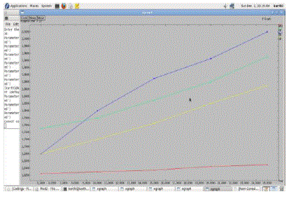
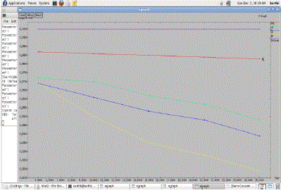
| • Through Graph Analysis, we analyse our and we evaluate the impact of varying the mobility dynamics and
traffic load on the performance of APU and also compare it with periodic beaconing and two recently
proposed updating schemes: distance-based and speed-based beaconing (SB). |
| • The simulation results show that APU can adapt to mobility and traffic load well. |
| • For each dynamic case, APU generates less or similar amount of beacon overhead as other beaconing schemes
but achieve better performance in terms of packet delivery ratio, average end-to-end delay and energy
consumption. |
ADVANTAGES OF PROPOSED SYSTEM |
| • The Proposed Scheme eliminates the drawbacks of periodic beaconing by adapting to the system variations. |
| • The simulation results show that APU can adapt to mobility and traffic load well. |
| • Achieve better performance in terms of packet delivery ratio, average end-to-end delay and energy
consumption. |
| • The main reason for all these improvements in APU is that beacons generated in APU are more concentrated along the routing paths, while the beacons in all other schemes are more scattered in the whole network. |
| • In APU, the nodes located in the hotspots, which are responsible for forwarding most of the data traffic in the
network have an up-to-date view of their local topology, thus resulting in improved performance. |
V. PSEUDO CODE |
| Step 1: Detect node location |
| Step 2: If a node location changes, mobility prediction is applied. |
| Step 3: If node moves randomly then it can't be predicted |
| Step 4: If deviation greater than threshold (called acceptable error range, AER) ->packet send |
| Step 5: Neighbouring nodes get packets from node |
| Step 6: If data overhears by new node then broadcast beacon as response |
| Step 7: Identifying new node which isn't contains in the neighbours list |
| Step 8: Before responding with beacon to prevent collisions with other beacons |
| Step 9: if (new node isn't in neighbours list) ->Add new node to neighbour list |
VI. SIMULATION RESULTS |
| The The Simulations have been shown through the network simulator (NS2), and by using the TCL tool and
Network Animator Window (NAM). |
VII. CONCLUSION AND FUTURE WORK |
| In this project, the need to adapt the beacon update is identified and the corresponding policy is employed in
geographic routing protocols to the node mobility dynamics and the traffic load. The Adaptive Position Update (APU)
strategy is proposed to address these problems. The APU scheme employs two mutually exclusive rules. The MP rule
uses mobility prediction to estimate the accuracy of the location estimate and adapts the beacon update interval
accordingly, instead of using periodic beaconing. The ODL rule allows nodes along the data forwarding path to
maintain an accurate view of the local topology by exchanging beacons in response to data packets that are overheard
from new neighbours. Performance of APU is evaluated using extensive NS-2 simulations for varying node speeds and
traffic load. Results indicate that the APU strategy generates less or similar amount of beacon overhead as other
beaconing schemes but achieve better packet delivery ratio, less overhead and energy consumption. |
| |
Figures at a glance |
 |
 |
 |
| Figure 1 |
Figure 2 |
Figure 3 |
| |
 |
 |
 |
| Figure 4 |
Figure 5 |
Figure 6 |
|
| |
References |
- J. Hightower and G. Borriello, “Location Systems for Ubiquitous Computing,” Computer, vol. 34, no. 8,pp. 57-66, Aug. 2001.
- B. Karp and H.T. Kung, “GPSR: Greedy Perimeter Stateless Routing for Wireless Networks,” Proc. ACM MobiCom, pp. 243-254, Aug. 2000.
- L. Blaze Vic, S. Giordano, and J.-Y. Libode, “A Location Based Routing Method for Mobile Ad Hoc Networks,” IEEE Trans. MobileComputing, vol. 4, no. 2, pp. 97-110, Mar. 2005.
- Y. KO and N.H. Vaidya, “Location-Aided Routing (LAR) in Mobile Ad Hoc Networks,” ACM/Blazer Wireless Networks, vol. 6, no. 4, pp.307-321, Sept. 2002.
- Michele Zorzi, Senior Member and Ramesh R. Rao, Senior Member, IEEE. Geographic Random Forwarding (GeRaF) for Ad Hoc and Sensor Networks: Energy and Latency Performance. IEEE Trans. Mobile Computing, VOL. 2, NO. 4, oct-dec 2003.
- Erik Kuiper and Simin Nadjm-Tehrani, Member, IEEE. Geographical Routing With Location Service in Intermittently Connected MANETs.IEEE Trans. on vehicular technology, VOL. 60, NO. 2, Feb. 2011.
- D. Johnson, Y. Hu, and D. Maltz, The Dynamic Source Routing Protocol (DSR) for Mobile Ad Hoc Networks for IPv4, IETF RFC 4728, vol.15, pp. 153-181, Feb. 2007.
- Ljubica Blazevic, Member, IEEE, Jean-Yves Le Boudec, Fellow, IEEE, and Silvia Giordano.A Location-Based Routing Method for Mobile AdHoc Networks , IEEE Trans. Mobile Computing,VOL. 3, NO. 4, oct-dec 2004.
- Z.J. Haas and B. Liang, “Ad Hoc Mobility Management with Uniform Quorum Systems,” IEEE/ACM Trans. Networking, vol. 7, no. 2, pp.228-240, Apr. 1999.
- J. Yuan, Z. Li, W. Yu, and B. Li, “A Cross-Layer Optimization Framework for Multihop Multicast in Wireless Mesh Networks,” IEEE J.Selected Areas in Comm., vol. 24, no. 11, pp. 2092-2103, Nov. 2006.
|
BIOGRAPHY |
Pasupuleti Neelima is an M.Tech student in Department of Computer Science and Engineering in INTELL
Engineering College Anantapur affiliated to Jawaharlal Nehru Technological University - Anantapur, Andhra Pradesh,
India. Area of interest is Sensor Networks, Mobile Ad Hoc Networks and Network Security. |
K.Bhargavi completed her M.Tech in the Department of Computer Science and Engineering, and currently working as
an Assistant professor in INTELL Engineering College Anantapur affiliated to Jawaharlal Nehru Technological
University - Anantapur, Andhra Pradesh, India. Her Area of Interest is Networking, Internet Programming, and
Network Security. |