Keywords
|
| Remote Sensing, Liss IV data, Near-Infrared band, gaussion homomorphic filter, segmentation techniques. |
I. INTRODUCTION
|
| In remote sensing energy emanating from the earthâÃâ¬ÃŸs surface is measured using a sensor mounted on an aircraft or spacecraft platform. The energy can be reflected sunlight so that the image recorded is, in many ways, similar to the view we would have of the earthâÃâ¬ÃŸs surface from an aeroplane, although the wavelengths used in remote sensing are often outside the range of human vision [1]. Electromagnetic energy is generated by several mechanisms, including changes in the energy levels of electrons, acceleration of electrical charges, decay of radioactive substances, and the thermal motion of atoms and molecules. Nuclear reactions within the Sun produce a full spectrum of electromagnetic radiation, which is transmitted through space without experiencing major changes. As this radiation approaches the Earth, it passes through the atmosphere before reaching the EarthâÃâ¬ÃŸs surface. Some is reflected upward from the EarthâÃâ¬ÃŸs surface; it is this radiation that forms the basis for photographs and similar images [2]. There are different types of satellite data available such as panchromatic data (single band), multispectral data ( up to 10 bands) and hyperspectral data ( 10 to 200 and above bands).Liss IV data as if a Multispectral data with three bands such as Green band (0.52 to 0.59μm), Red band (0.62 to 0.68 μm) and Near Infrared band (0.77 to 0.86 μm) and resolution is 5 meter per digital number. Infrared red band only applied in image enhancement and segmentation techniques. |
II. RELATED WORK
|
| A novel approach using vector roads to aid in generating seams for aerial image mosaicking [3]. A semiautomatic method for 3-D road extraction in rural areas using stereoscopic aerial images. A strategy based on the dynamic programming algorithm provides a solution to the road extraction problem in the object space. The extraction process begins by first measuring a few seed points in one image of the stereoscopic pair and then transforming these into the object-space reference system. The proposed method was efficient and usually provided accurate road centrelines [4]. This method exploits the properties of road segments to develop customized operators to accurately derive the road segments. The customized operators include directional morphological enhancement, directional segmentation and thinning. This is systematically evaluated the algorithm on a variety of images from IKONOS, Quick Bird, CARTOSAT-2A [5]. A direction-based cumulative voting technique is developed to evaluate reliability of each road segment. Finally, inferred road features are back projected onto depth and intensity image to test their validity. Although experimental results show a good completeness and correctness, the proposed method is limited only to linear road extraction [6]. A road damage extraction method based on object-oriented change detection method using road vector data overlaid on post-earthquake image. It is complex to identify all kinds of road damages in earthquakes. For the purpose of traffic capacity analysis, focusing on roads in good condition will simplify the problem, no matter how the roads are destroyed. The whole road line is provided by road network vector of appropriate scale [7]. The common road extraction from high-resolution imagery is based on spectral information only; it is difficult to separate road features from background completely, and a thinning algorithm always results in short spurs which reduce the smoothness of the road centerline. To overcome the aforementioned shortcomings of the common existing road centerline algorithms, this letter presents a new method to extract the road centerline from high-resolution imagery based on shape features and multivariate adaptive regression splines (MARS), in which potential road segments were obtained based on shape features and spectral feature, followed by MARS to extract road centrelines. Two experiments are performed to evaluate the accuracy of the proposed method [8]. Above works are road extracted from various satellite images except Liss IV data. |
III. PROPOSED WORK
|
| A. Study Area |
| Study territory is topographically found at Tamilnadu, India. This study range is secured Madurai area in Tamilnadu. Scope and longitude worth considered from above information report. Above information having diverse item unearthly data like street, building, vegetation region, mountains and water bond focused around electromagnetic range transfer speed. On the other hand, this information secured area surface just aside from ocean or sea. |
| B. Feature Selection |
| This proposed work is road just extraction from aforementioned remotely sensed information. Wellspring of the daylight and electromagnetic range phantom data road ghostly data exceedingly reflected in near-infrared band. Road offer just extricated from near-infrared band for mapping and Global Positioning System. So near-infrared band just chose from over three bands. In this way, we require not combination over these three bands. This near-infrared band must contain distinctive sorts of streets, for example, National thruways, state highways and Madurai City Street secured inside this band. |
| C.Input Image |
| Input image considered testing images selected area only cropped from near-infrared band. There are six different types area cropped as it covered with national highways, state highways, cross road, rural area road and airport also. Each image in size with 256 x 256 pixels cropped from original data without resize. These images likely cropped without loss of information and original image file format. . Already this band recorded with 5.8 meter resolution per pixel so cropped image having 256 x 256 pixels and it may be total coverage on earth surface 1.280 square kilometres. Following selected area images cropped from original data and used for road detection using existing algorithm and proposed algorithm. |
| Above input images likely given in various filtering techniques for enhancement and noise removed from images and this preprocessing step done. After enhancement, images tested for road segmentation. |
D: Image Enhancement using Gaussian Homomorphic filter
|
| An Image Processing image enhancement is broad research area and preprocessing for feature extraction from remote sensing data. There are many enhance techniques available in image processing in image processing system. There is very important domain is spatial domain and frequency domain. Noise as an unwanted component of the image and it occurs in images for many reasons. Homomorphic filtering is one of the image enhancement techniques based on frequency domain. This is a generalized technique for image processing and signed processing, involving a nonlinear mapping to a various domain in which linear filter techniques are applied, followed by mapping return to the original domain. Homomorphic filter is simultaneously normalizing the brightness an image and increase contrast. Here homomorphic filter is used to remove the Gaussian noise. |
Gaussian noise
|
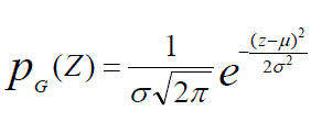
| Gaussian noise is statistical noise having a probability density function equal to that of the normal distribution, which is also known as the Gaussian distribution[9][10]. Principal sources of Gaussian noise in digital images arise during acquisition. For example, these sensor noises are caused by poor illumination [11]. In digital image processing system, the Gaussian noise can be reduced using a spatial filter and frequency filter, an undesirable outcome may result in the blurring of fine-sealed image edges and also correspond to blocked high frequencies [12].Gaussian values that the noise can take on are Gaussian distributed. The probability density function name p of a Gaussian random variable z is given by |
 eq.(1) eq.(1) |
| Where z in a gray level, μ the mean value and σ is the standard deviation [13].This Gaussian noise applied in homomorphic filtering technique. Therefore, it is called as Gaussian noise based homomorphic filtering or Gaussian Homomorphic filter. In homomorphic filtering illumination and reflectance are made additive by taking the logarithm of the image intensity. Therefore, these components of the image can be separated linearly in the frequency domain. The high frequency components are increased and low frequency components are assumed to represent mostly the reflectance in image, the low frequency components are assumed to represent mostly the illumination in an image. |
| The Function of the homomorphic filter is likely to decrease the low frequency and increase the high frequency. For the remote sensing images, the homomorphic filtering gives the contrast extending to the lower gray level enhancing the contrast. The high-pass filter used to suppress low frequency and amplify high frequencies in the log intensity domain [14]. The final step is to apply the exponential function to invert the log-transform and get the Gaussian based Homomorphic filtered image. Figure 5.1 to 5.6 shows the Gaussian homomorphic filter result and table 1.1 shows the PSNR value of the Gaussian Homomorphic filter. |
IV. COMPARATIVE ANALYSIS
|
| There are two existing segmentation algorithms are used and compared to road extraction from liss iv data such as Genetic algorithm and active contour model based segmentation. |
A.Genetic Algorithm based segmentation
|
| In a Genetic algorithm, a population of strings called chromosomes, which encode candidate solution to an optimization problem, evolves toward better solution. The evolution usually starts from a population randomly generated individuals and happens in generations. In each generation, the strength of every individuals in the populations is evaluated and multiple individuals are stochastically selected from the current population ( based on their fitness) and modified (crossover and mutation) to form a new population. Image segmentation denotes a process by which input image is partitioned into non-overlapping regions. Each region is homogeneous and connected. The union of any two spatially adjacent regions is not homogeneous. |
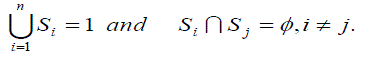
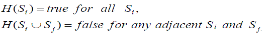
| Each region in a segmented image has to satisfy properties of homogeneity and connectivity. The region is considered homogeneous if all region piels satisfy homogeneity conditions defined per one or more pixel attributes, such as intensity, color, texture, etc. The region is connected if a connected path between any two pixels within the region exists. If I is a set of all image pixels and H(.) is a homogeneity predicate defined over connected pixel groups, then the image segmentation is portioning of I into connected subsets{S1,S2,.....,Sn} so that |
 eq. (2) eq. (2) |
| The homogeneity predicate is |
 eq. (3) eq. (3) |
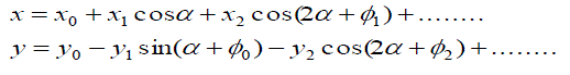
| Computation of such image partitions has a very high combinational complexity. No general solution for all segmentation cases exist.Because of a very big solution space, gentic algorithms ere adopted by several researchers . GAâÃâ¬ÃŸs was applied to optimize parameters of various segmentation techniques as well as to develop new techniques. One of modern segmentation techniques is a Shape description caused by energy funtion and possible shape deformation. In to detect road boundaries in infrared images road shape is described by an irregular parametric ellipsoid defined by |
 eq. (4) eq. (4) |
| Shape fitting in the image is performed by minimizing energy function adopted from. |
 eq. (5) eq. (5) |
 eq. (6) eq. (6) |
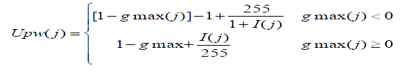
| Where Upw is energy function for posterior wall and Us is energy for septum, gmax(j) is maximum gradient in direction to a normal of ellipsoid boundary. |
| Each elliptical contour is encoded as a chromosome which genes contain harmonic components of elliptic contour and two position elements. Genetic algorithm tries to minimize energy function U guiding contour to optimal segmentation of echocardiography image and extracting cardiac boundaries. Fine segmentation is achieved through the knowledge of image incorporation into optimization process through adjustable parameter ranges. Such an approach allows segmentation an image with incomplete heart boundaries as well as increases resistance to noise.Lucia Ballerini did an extensive research on snakes algorithm parameters optimization by using genetic algorithms. Cagnoni et al. use elastic contour model to segment medical images in the search for a particular anatomical structure. They use GA to optimize energy function derived from snakes algorithm, thus driving contour into an optimal position. |
B. Active contour model based segmentation
|
| The basic idea in active contour models like snakes is to evolve a curve and subject to constraints from a given image, in order to detect road or line in that image. For instance, starting with a curve around the object to be detected, the curve moves toward its interior normal and has to stop on the boundary of the object[15]. |
| In the classical snakes and active contour models, an edge-detector is used, depending on the gradient of the image , to stop the evolving curve on the boundary of the desired object. Because all these classical snakes and active contour models rely on the edge-function , depending on the image gradient , to stop the curve evolution, these models can detect only objects with edges defined by gradient. In practice, the discrete gradients are bounded and then the stopping function is never zero on the edges, and the curve may pass through the boundary. If the image is very noisy, then the isotropic smoothing Gaussian has to be strong, which will smooth the edges too. There are different active contour model, without a stopping edge-function, i.e. a model which is not based on the gradient of the image for the stopping process. The stopping term is based on Mumford–Shah segmentation techniques. In this way, we obtain a model which can detect contours both with or without gradient, for instance objects with very smooth boundaries or even with discontinuous boundaries. In addition, our model has a level set formulation, interior contours are automatically detected, and the initial curve can be anywhere in the image. Further details about active contour model refer in [15]. |
V. PERFORMANCE RESULTS
|
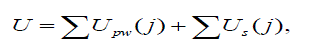
| These algorithms implemented and tested with MATLAB. Above algorithms are compared using performance metrics like Accuracy only. We considered the best road segmentation algorithm for particular data using performance metrics. Our results show that the road extraction from liss iv data based on performance metrics and identified best segmentation algorithm like Active contour model based segmentation. Fig 1.1 to Fig 11.6 shows the segmented result of Active contour model. Table 1 shows the Accuracy values of Genetic algorithm (GA) and Active contour model (ACM). Fig 1.7 shows the performance variations of GA and ACM. Fig 1.8 shows the flowchart of the work. |
 |
VI. CONCLUSION AND FUTURE WORK
|
| The results shows that the comparative algorithms such as genetic algorithm based segmentation and active contour model based road segmentation from remote sensing liss iv data.. Finally, active contour model is suitable for road extraction from Liss IV data based on evaluation of performance metrics. Liss IV infrared band having 5.8 meter resolution per pixel so this is low visibility and very complicated to extraction of street roads from Liss IV data. We can use very high-resolution images like below 1 meter resolution is suitable for extraction of street roads from satellite images in future work. |
Tables at a glance
|
 |
| Table 1 |
|
| |
Figures at a glance
|
 |
 |
 |
 |
 |
| Figure 1 |
Figure 2 |
Figure 3 |
Figure 4 |
Figure 5 |
|
| |
References
|
- John A. Richards. XiupingJia, „Remote Sensing Digital Images Analysis- An Introduction 4th EditionâÃâ¬ÃŸ, Springer Berlin Heidelberg New York,ISBN-13 978-3-540-25128-6
- James B.Campbell and Randolph H. Wynne, „Introduction to Remote SensingâÃâ¬ÃŸ, 5th Edition, The Guilford Publications, ISBN 978-1-60918-176-5.
- Youchuan Wan, Dongliang Wang, Jianhua Xiao, Xiang Wang, Yongsheng Yu, and JingzhongXu, “Tracking of Vector Roads for theDetermination of Seams in Aerial Image Mosaics”, IEEE Geoscience and Remote Sensing Letters, Vol. 9, No. 3, May 2012
- Aluir P. Dal Poz, Rodrigo A. B. Gallis, João F. C. da Silva, and Érico F. O. Martins, “Object-Space Road Extraction in Rural Areas UsingStereoscopic Aerial Images”, IEEE Geoscience and Remote Sensing Letters, Vol. 9, No. 4, July 2012.
- D. Chaudhuri, N. K. Kushwaha, and A. Samal, “Semi-Automated Road Detection From High Resolution Satellite Images by DirectionalMorphological Enhancement and Segmentation Techniques ”, IEEE Journal of Selected Topics in Applied Earth Observations And RemoteSensing, Vol. 5, No. 5, October 2012.
- Jiaping Zhao, Suya You, Jing Huang, Rapid Extraction and Updating of Road Network from Airborne LiDAR Data”, IEEE 2012
- Lixia Gong, Liqiang An, Mingzhong Liu, Jingfa Zhang, “Road Damage Detection From High-Resolution RsImage”,IEEE 2012
- Zelang Miao, Wenzhong Shi, Hua Zhang, and Xinxin Wang, “Road Centerline Extraction From High-Resolution Imagery Based on ShapeFeatures and Multivariate Adaptive Regression Splines”, IEEE Geoscience and Remote Sensing Letters, Vol. 10, No. 3, May 2013
- TudonBarbu, “Variation image denoising approach with diffusion porous media flow”, 2013. Doi:10.1555/2013/856876.
- Barry Truax, ed, Handbook for acoustic ecology, Cambridge street publishing, 1999.
- philippecattin, image restoration: introduction to signal and image processing, MIAC, University of Basel, 2013.
- Robert fisher, Simon Perkins, Ashley walker, Erik Wolfart, “Image synthesis noise generation”.
- T.Huang, G.Yarg, and G.Tang, “A fast two-dimensional median filtering algorithm”, IEEE trans. Acoust, speech signal processing, vol 27,no.1, pp.13-18, 1979.
- Douglas B.williams and Vijay Madisetti, “Digital signal processing handbook”,1999.
- Tony F. Chan, and Luminita A. Vese, “Active Contours Without Edges”, IEEE Transactions On Image Processing, Vol. 10, No. 2, February2001.
- Manisha Sharma and VandanaChouhan. (2012). Objective Evaluation Parameters of Image Segmentation Algorithms. International Journal ofEngineering and Advanced Technology (IJEAT) ISSN: 2249 – 8958, Volume-2, Issue-2.
|
BIOGRAPHY
|
| T.Ganesh Kumar and Manish T.I are research Scholars in the Department of Computer Science and Engineering, Manonmaniam Sundaranar University, Tirunelveli. They are received Master of Engineering degree in Computer Science and Engineering from Manonmaniam Sundaranar University, Tirunelveli, India. Dr.D.Murugan is an Associate professor in the department of computer science and Engineering, Manonmaniam Sundaranar University, Tirunelveli, India. He is a Principal Investigator of the two-funded research project such as UGC Major Project, Government of India, Science and Engineering Research Board, Department of Science and Technology, Government of India. |